

Fleet managers in commercial sectors know the challenge well: vehicles leave the depot and operational visibility drops. Unauthorized use, excessive idling, and disputed insurance claims all quietly erode margins. A structured GPS tracking workflow addresses each of these problems at the process level, not just the technology level. GPS tracking systems can reduce fuel costs by 12-20% in the first year through route and idle-time optimization alone. This guide walks you through every phase, from preparation to verification, so your deployment produces measurable results.
Key Takeaways
| Point | Details |
|---|---|
| Preparation is crucial | Align policies, define KPIs, and choose devices before deployment to ensure GPS tracking success. |
| Behavior-based geofencing | Use learning algorithms and critical zone focus to minimize false alerts and maximize safety. |
| Integrate for compliance | Link GPS tracking with maintenance and inspection workflows for seamless audits and safety checks. |
| Verify and optimize | Regularly review reports and tune settings to improve ROI and reduce operational risks. |
| Leverage full telematics | Collect speed, braking, and timestamp data to strengthen insurance claims and driver accountability. |
Preparing your fleet for the GPS tracking workflow
Getting hardware installed is the easy part. The real work happens before a single device is mounted. Fleets that skip preparation end up with data no one acts on, drivers who distrust the system, and managers who can't connect GPS outputs to fleet goals.
Effective GPS deployment requires policy alignment and governance first, covering five key steps including data integration, privacy policies, and device selection. Start there.
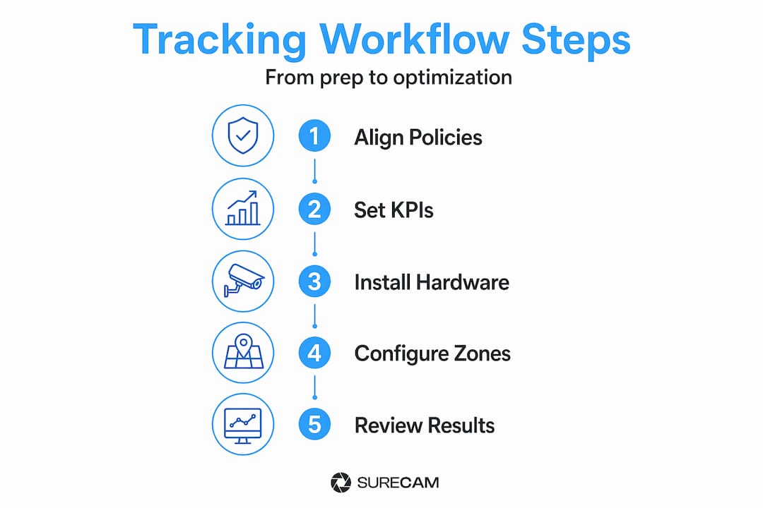
Policy and governance checklist
Before deployment, confirm these items are in place:
- Driver notification policy: Inform drivers in writing that vehicles are tracked. This is both a legal requirement in many states and a trust-building step.
- Data access controls: Define who can view location data, pull reports, and set geofence alerts.
- Retention policy: Specify how long location data is stored and who can request deletion.
- Acceptable use policy: State what constitutes a policy violation and the escalation process.
Defining KPIs before you install anything
Vague goals produce vague results. Set specific, measurable targets before go-live. Here are the most useful KPIs for commercial fleets:
| KPI | Baseline measurement | Target improvement |
|---|---|---|
| Fuel cost per mile | Current average from fuel cards | 12-20% reduction, year one |
| Idle time per vehicle/day | Manual logs or fuel data | Below 10 minutes/shift |
| Unauthorized after-hours use | Incident reports | Near zero within 90 days |
| Utilization rate | Dispatch records | Above 75% fleet-wide |
| Insurance claim frequency | Prior 12-month claims | 20%+ reduction by year two |
Selecting the right device for each vehicle type
Not every vehicle in your fleet has the same risk profile or installation requirements.
- OBD-II plug-in devices work well for light-duty vehicles and short-term deployments. They're easy to install but easier to unplug.
- Hardwired units are better for heavy-duty trucks, vans, and vehicles with higher theft or misuse risk.
- Asset trackers suit trailers, equipment, and non-powered assets that move between jobs.
- Integrated dash cam and GPS units give you location data plus video evidence in a single device, which is the most useful configuration for insurance and safety purposes.
Pro Tip: Map your vehicle mix against risk profiles before ordering hardware. A delivery van on urban routes needs different coverage than a utility truck on remote job sites.
For more detail on optimizing device selection and scheduling, review these step-by-step fleet tracking tips and how saving fuel with GPS tracking works in practice.

Executing the GPS tracking workflow in your fleet operations
With preparation complete, deployment moves through three phases: hardware installation, system configuration, and behavioral calibration. Each phase has failure points worth knowing in advance.
Phase 1: Installation and pilot testing
- Install devices on a pilot group of 10-15% of your fleet before full rollout.
- Verify GPS signal accuracy by driving known routes and comparing logged paths to actual routes.
- Confirm data is flowing correctly into your fleet management platform within 24 hours of install.
- Document any signal gaps at regular depot locations or underground parking areas and note them in your system.
- Only proceed to full fleet installation after pilot data confirms accuracy and reporting consistency.
Phase 2: Geofencing configuration
Geofencing creates virtual perimeters that trigger instant alerts for unauthorized vehicle use, reducing overtime by 20% and unauthorized use by up to 74%. That kind of impact depends entirely on how you set up the zones.
Start with high-impact locations only:
- Main depot and secondary storage yards
- High-value customer sites where vehicle presence must be logged
- Restricted areas such as school zones or residential streets during off-hours
- Known theft-risk areas based on historical incident data
Avoid creating more than 15-20 zones in the first 30 days. Alert volume from over-configured geofencing is one of the most common reasons managers disengage from the system entirely.
| Configuration approach | Alert volume | Effectiveness |
|---|---|---|
| Every possible location geofenced | Very high, leads to fatigue | Low over time |
| Only critical zones, first 30 days | Manageable | High, builds trust |
| Tiered zones by severity level | Moderate, prioritized | Highest long-term |
Phase 3: Behavioral calibration
Allow 2-3 weeks of data collection before drawing conclusions on driver behavior. Early data often flags sharp turns on rough roads as "harsh cornering" or brief acceleration merging onto highways as "aggressive driving." Calibration reduces these false alerts.
During this period, monitor the following behaviors for real safety signals:
- Speeding above set thresholds on specific road types
- Harsh braking events in specific zones (near schools, depots)
- After-hours ignition events outside approved schedules
Pro Tip: Share aggregated, anonymized behavioral data with drivers in a team meeting after the first calibration period. Transparency about what the system flags builds acceptance and reduces resistance.
For a full breakdown of how this fits into a broader safety framework, the vehicle tracking guide covers practical configuration scenarios.
Verifying performance and optimizing your GPS tracking workflow
Deployment without verification is just installation. The verification phase converts raw GPS data into operational decisions and demonstrates ROI to stakeholders.
Metrics to track against your baseline KPIs
- Fuel cost per mile, compared monthly against pre-deployment average
- Number of after-hours ignition events per week
- Geofence breach count and resolution time
- Incident and near-miss reports with GPS timestamp correlation
- Insurance claim frequency and average settlement time
"Fleets using GPS tracking with geofencing can receive up to 30% insurance discounts, and 62% of users see positive ROI from lower administrative costs and fewer disputes."
Reporting structure that supports audits
Set up two reporting cadences from day one:
| Report type | Frequency | Audience | Purpose |
|---|---|---|---|
| Driver behavior summary | Daily | Fleet supervisors | Early intervention |
| Geofence compliance log | Weekly | Operations manager | Audit trail |
| Fuel and idle-time analysis | Monthly | Finance and fleet manager | Cost tracking |
| Incident correlation report | As needed | Safety team and insurers | Claims support |
Managing alert fatigue
Alert fatigue is the silent killer of GPS tracking ROI. When managers receive hundreds of alerts daily, they stop reading them. Prevent this by:
- Assigning severity levels (critical, warning, informational) to each alert type
- Routing critical alerts to mobile and email, informational alerts to a dashboard only
- Reviewing and pruning geofence zones every 60 days based on actual alert resolution rates
- Removing zones that generate alerts but never lead to corrective action
Pro Tip: If your alert-to-action ratio drops below 1 in 10, your zone configuration needs a review. High-volume, low-action alerts are a setup problem, not a driver problem.
For deeper guidance on combining GPS data with video evidence, video telematics best practices outlines how real-time footage accelerates insurance resolution.
Integrating GPS tracking with maintenance and compliance workflows
Location data becomes significantly more valuable when it connects to maintenance schedules and regulatory compliance. Most fleets treat GPS as a stand-alone tool. The ones that integrate it see compounding returns.
Mileage-triggered maintenance
GPS tracking supports automated mileage-based maintenance triggers when integrated with fleet management systems. Set your system to automatically open a work order at defined mileage intervals. This removes the manual step of checking odometers and ensures no vehicle exceeds service thresholds.
Key integration steps:
- Export daily mileage totals from your GPS platform via API or scheduled report.
- Map vehicle IDs to your fleet maintenance system records.
- Set threshold alerts at 90% of service interval so scheduling happens before the vehicle hits the limit.
- Log completed maintenance against GPS-recorded mileage for a complete service history.
Compliance and inspection integration
Custom geofences can auto-generate non-compliance reports for inspection skips, enforcing accountability without manual oversight. This is particularly useful for FMCSA-regulated fleets.
Configure depot geofences to work alongside pre- and post-trip inspection records:
- When a vehicle departs the depot geofence, the system checks whether a pre-trip DVIR was completed that morning.
- If no DVIR is logged, an alert is generated and sent to the supervisor automatically.
- Daily reports identify drivers with repeated inspection skips, creating a documented accountability trail.
- GPS timestamps paired with Hours of Service records confirm drivers were at the correct location during required rest periods.
This integration model eliminates the manual audit process and generates fleet compliance documentation that holds up under DOT review.
Pro Tip: Build a monthly compliance dashboard that shows DVIR completion rates by driver alongside GPS departure timestamps. Gaps between the two are your compliance risk indicators.
Why a GPS tracking workflow is more than just hardware installation
Here is what most deployment guides miss: installing GPS devices is an IT task. Building a GPS tracking workflow is an operational program. Those are fundamentally different things, and confusing them is the most common reason fleets see poor ROI.
A device sends data. A workflow decides what that data means, who acts on it, when, and how. GPS tracking deployment requires structured governance, not just hardware installation, to fully realize operational benefits. That means defining what a geofence breach actually costs your business. It means connecting idle-time data to fuel card reconciliation. It means training supervisors to read a driver behavior report the same way they'd read a safety inspection finding.
The fleets that get real returns from GPS tracking treat it the way they treat any other operational control: regular reviews, clear ownership, and direct links to performance targets. They don't wait for incidents to review data. They schedule it like a maintenance interval. And they communicate openly with drivers about what the system monitors and why.
The second thing most guides undervalue is the insurance angle. Full telematics data, including speed logs, braking events, and GPS timestamps, is not just useful after an incident. It's a negotiating asset with your insurer at renewal. Presenting 12 months of clean behavioral data alongside a documented geofencing program changes the conversation from claims history to risk profile. That shift is worth more than the hardware ever cost.
For practical steps on making this program work end-to-end, the fleet tracking optimization guide provides a structured starting point.
Explore fleet GPS tracking and dash cam solutions for enhanced safety
As you refine your GPS tracking workflow, integrating video telematics takes fleet visibility to the next level. Location data tells you where a vehicle was. Video tells you what happened there.
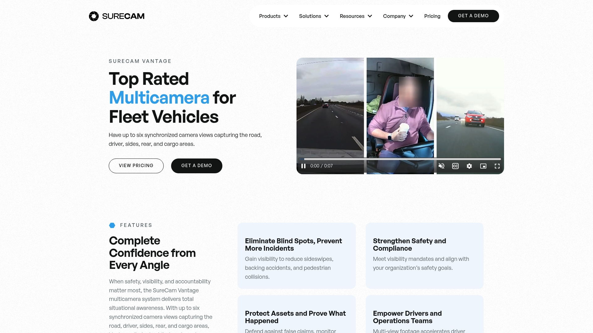
SureCam's GPS-connected fleet cameras are built specifically for commercial fleets, combining real-time location tracking with AI-powered driver coaching and cloud-stored video evidence. When a geofence alert fires, video footage from that moment is already logged and accessible. For fleets managing insurance claims, that combination reduces dispute resolution time significantly. The dual-facing dash cam captures both road events and driver behavior simultaneously, while the SureCam Vantage multicamera system provides full-vehicle coverage for high-value assets and complex operations. Both systems integrate directly with GPS data for complete incident documentation.
Frequently asked questions
What is a GPS tracking workflow in fleet management?
A GPS tracking workflow is a structured process covering preparation, deployment, and ongoing verification of a GPS tracking system to improve fleet safety, operational efficiency, and regulatory compliance. It connects device data to operational decisions through defined policies, KPIs, and reporting cadences.
How does geofencing improve fleet safety and reduce costs?
Geofencing sets virtual boundaries around key locations and sends instant alerts when vehicles enter or leave outside approved times, achieving a 74% reduction in unauthorized use and cutting idle-time fuel costs by up to 18%. It also creates audit-ready records for compliance and insurance purposes.
Can GPS tracking lower my fleet's insurance premiums?
Yes. Fleets using GPS tracking with documented geofencing programs can qualify for up to 30% insurance discounts based on demonstrated safety improvements, theft prevention measures, and recorded maintenance history.
What are common pitfalls when deploying GPS tracking?
The most frequent issues are poor policy alignment before deployment, over-configured geofence zones that create alert fatigue, and collecting GPS location data without linking it to structured governance and KPIs, all of which reduce system effectiveness and driver trust over time.